Top 15 Largest Lakes in East Texas
In the East Texas area there are over 50 lakes offering a variety of outdoor activities for vacations or weekend outings.
Discussed on this page are the 15 largest larkes in the East Texas area. Also included below is a list of all East Texas lakes with their sizes, and an interactive map of East Texas lakes.
#1 - Toledo Bend Reservoir
|
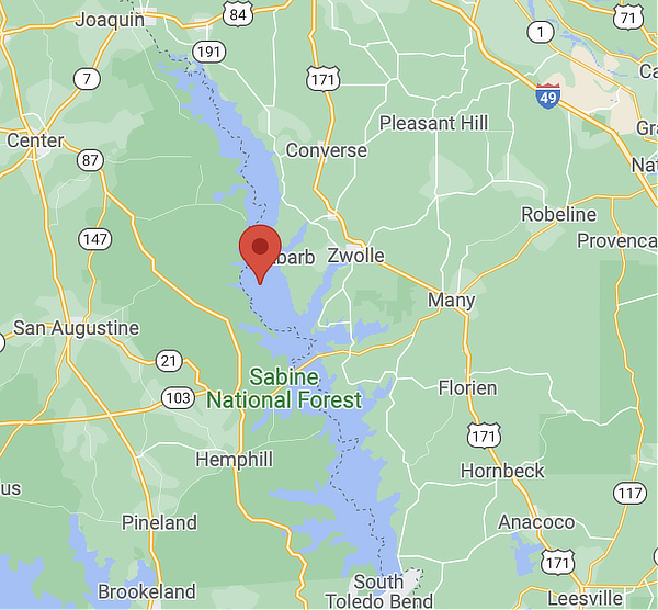 |
Toledo Bend Reservoir lies along the Texas-Louisiana border southeast of Tyler, and directly west of Many, Louisiana. This massive 181,600 acre lake is a project of the States of Texas and Louisiana, and has both recreational and power generation benefits. It has a maximum depth of 110 feet.
As the largest man-made lake in the south, Toledo Bend forms a portion of the boundary between the states of Texas and Louisiana. The lake extends 65 miles to the north to near Logansport, LA.
Boating, fishing, skiing, camping, hiking, golfing and other recreational activities are popular around this lake. RV resorts, campgrounds, resorts, restaurants, marinas, and motels are all available along the 1,200 miles of shoreline of the reservoir.
Toledo Bend Reservoir attracts numerous large fishing tournaments year-round because of the excellent fishing and the facilities available for such angling events.
Bassmaster Magazine has selected Toledo Bend Reservoir as the top fishery in the United States. Toledo Bend ranked above 230 potential lakes after the magazine conducted research and personal interviews with anglers from around the U.S.
Read more about Toledo Bend Reservoir
#2 - Sam Rayburn Reservoir
|
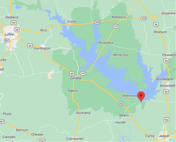 |
Sam Rayburn Reservoir is located on the Angelina River, and its dam is located in Jasper County approximately 15 miles north of Jasper. The lake has a surface area of 114,500 acres, and a maximum depth of 80 feet. The lake was impounded in 1965 and is the largest lake in Texas.
The most popular game fish at Sam Rayburn Reservoir is the largemouth bass; an excellent year-round fishery exists. Habitat in Sam Rayburn Reservoir consists of submerged aquatic vegetation, standing timber, and flooded terrestrial vegetation.
Twenty-two maintained access areas (including parks and private concessions) are located around the reservoir. Boat ramps are available at each of these areas. Some ramps may be unavailable for use when the lake is low, so it's a good idea to check with local authorities for current water levels and ramp conditions.
Thirteen parks are operated by the Corps of Engineers, and the rest by the U.S. Forest Service, Texas Parks & Wildlife Department, or county. Five access areas are operated by concessionaires or located in close proximity to a concession/marina.
Read more about the Sam Rayburn Reservoir
#3 - Lake Livingston
|
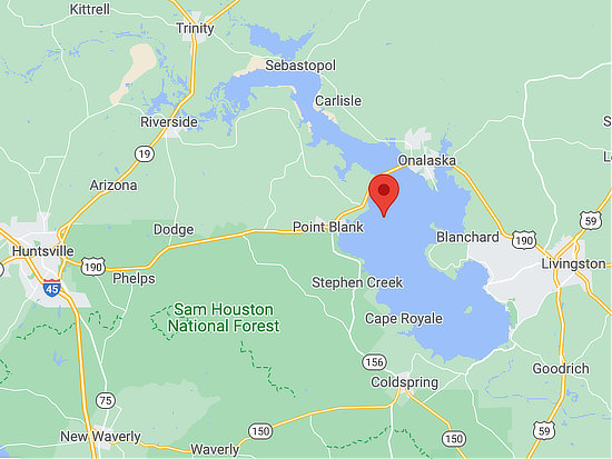 |
Lake Livingston was built, and is owned and operated, by the Trinity River Authority of Texas (TRA) under contract with the City of Houston for water-supply purposes. It is located on the Trinity River in Polk, San Jacinto, Trinity and Walker counties.
It covers 90,000 acres, and is 31 miles long and 9 miles wide. The lake is the second-largest lake located wholly within the state of Texas behind Sam Rayburn Reservoir at 114,500 acres.
The Livingston Dam, constructed across the Trinity River 7 miles southwest of the city of Livingston is 2.5 miles in length. The lake has an average depth of 55 feet, and a maximum depth of 90 feet.
Lake Livingston is a notable white bass fishery. White bass are plentiful and grow to large sizes. Also notable is the catfish fishery, dominated by blue catfish. Largemouth bass, striped bass, and crappie are less abundant but good catches are possible in areas of the reservoir where habitat is available.
Read more about Lake Livingston
#4 - Richland-Chambers Reservoir
|
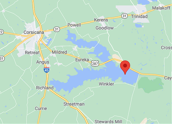 |
The Richland-Chambers Reservoir is the third largest inland reservoir by surface area (behind the Sam Rayburn Reservoir and Lake Livingston) and the 8th largest reservoir by water volume in Texas. It was formed by the impoundment of Richland Creek and Chambers Creek east-southeast of the town of Corsicana and south of Kerens, in Navarro County and Freestone County, Texas, USA. It has 330 miles of shoreline and is "Y" shaped with the dam located on the eastern end of the lake. It was formerly known as the Richland Reservoir.
Due to a drought in 1956-1957 plans were made by the Tarrant Regional Water District to build the Richland-Chambers Reservoir with the purpose of being a public water source for Tarrant County.
The reservoir was built by the Tarrant Regional Water District (TRWD) who retains most of the water rights. TRWD is a water wholesaler to 11 counties in Texas. This water is pumped from Richland-Chambers via a 90-inch (2,300 mm) pipeline to balancing reservoirs and on to Lake Benbrook for storage before moving to the water treatment plants or Eagle Mountain Lake.
Richland-Chambers Dam is an earthen embankment with a soil cement upstream face and six and half miles long with a maximum height 120 feet. The top of dam is at the elevation of 330 feet above mean sea level.
The reservoir is 60 miles southeast of downtown Dallas, with Interstate 45 running north-south just west of the reservoir.
Read more about Richland-Chambers Reservoir
#5 - Lake Tawakoni
|
 |
Lake Tawakoni, also known as the Iron Bridge Dam and Reservoir Project, was the first major project built by the Sabine River Authority of Texas.
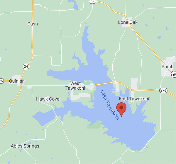
Lake Tawakoni has a surface area of about 37,879 acres, with a maximum depth of 70 feet. The dam is located about 10 miles northeast of Wills Point, and the reservoir lies within parts of Hunt, Rains, and Van Zandt Counties.
The project's primary purpose is one of water conservation and supply. The reservoir as-built storage capacity at conservation pool elevation of 437.5 mean sea level .
The South Fork, Cowleech Fork, and Caddo Forks that all formed the Sabine River headwaters are now submerged under the lake and the lake now serves as the headwaters of the Sabine River.
Nearby is the Lake Tawakoni State Park which offers fishing, boating, camping, hiking, birding and other outdoor activities. The State Park offers 376 acres with more than five miles of shoreline and a variety of activities, including swimming, fishing, boating, mountain biking, geocaching, hiking and birding.
Read more about Lake Tawakoni
#6 - Cedar Creek Reservoir
|
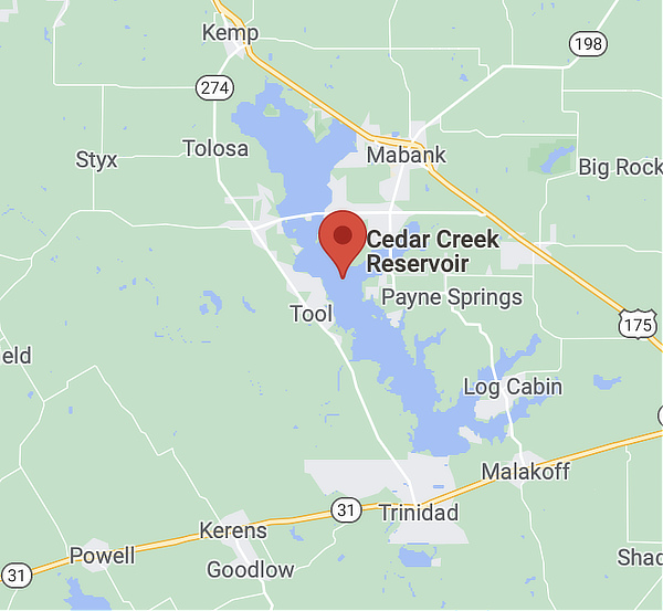 |
Cedar Creek Reservoir is located in Henderson and Kaufman Counties, Texas, 60 miles southeast of Dallas. It is built on Cedar Creek, which flows into the Trinity River.
It is also 15 miles west of Athens in the area between US 175 and Texas 274. The reservoir has a surface area of 32,623 acres, with a maximum depth of 53 feet, and is the fourth largest lake in Texas with over 320 miles of shoreline.
Sometimes called "Cedar Creek Lake", it is technically named Cedar Creek Reservoir, was completed in 1965 as a water source for Fort Worth and many other local communities in North Texas.
The lake is approximately 18 miles long and just over 2 miles wide. The shoreline stretches 220 miles from point to point. The lake also boasts three islands that are managed by the Texas Parks and Wildlife Department as Wildlife Management Areas for aquatic birds.
The lake offers a diverse range of fishing, water sports, boating, birdwatching, and other recreational activities. Purtis Creek State Park in Eustace is a short drive away.
Gun Barrel City offers an exciting lifestyle, for residents and visitors alike. Cedar Creek Reservoir is at the forefront of many attractions and things to do.
Read more about Cedar Creek Reservoir
#7 - Lake Fork
|
 |
At 27,264 acres and 315 miles of shoreline, Lake Fork was designed to be a premier bass fishing lake and currently holds records for 34 out of the Top 50 largemouth bass caught in Texas.
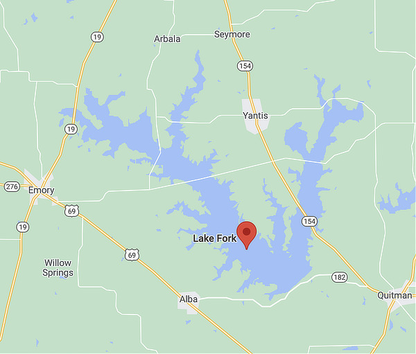
This popular lake located on the Sabine River in Hopkins, Rains and Wood Counties, 5 miles northwest of Quitman, and north of Mineola. It was impounded in 1980, and today reaches a depth of 70 feet.
Largemouth bass is the most popular sportfish in this reservoir. A combination of restrictive harvest regulations, stocking of Florida strain largemouth, and abundant habitat has contributed to Lake Fork's development as one of the country's premier trophy bass lakes.
The Toyota Texas Bass Classic is a world-class bass fishing tournament held each year at Lake Fork. It features the top tournament bass anglers in the world, along with a festival to include exceptional entertainment and a variety of family and industry activities.
A number of other high visibility fishing tournaments are also held at Lake Fork through the year, such as Berkley Big Bass, the Bud Light Tournament, Texas Trails Bassmasters, the Lake Fork Classic, Media Bass Team Tournament and many others.
Read more about Lake Fork
#8 - Lake Palestine
|
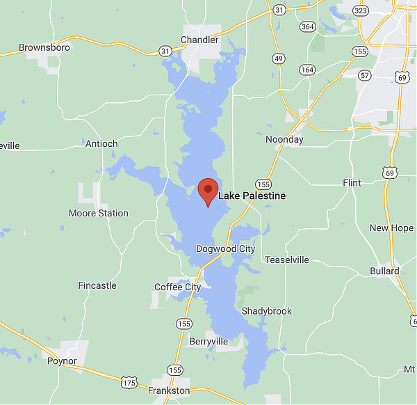 |
Lake Palestine is located about 15 miles southwest of Tyler, Texas, on Texas Highway 155, and resulting from a dam on the Neches River. It has a surface area of 25,560 acres, and was completed in 1962. Lake Palestine is the largest lake in the Tyler area.
Portions of Anderson, Cherokee, Henderson, and Smith Counties are included in the lake. The Neches River continues flowing southward from the dam, establishing the boundary between Anderson and Cherokee Counties.
The channel of the Neches River through Lake Palestine marks the boundary between Henderson County and Smith County.
Lake Palestine offers recreation and outdoor activities for everyone, with boating, water skiing, houseboating, camping, RVing, canoeing, hiking, biking, and fishing all being popular activities.
The lake is very popular for largemouth bass tournaments due to its consistent success.
It also offers waterfront and lakeside living for many Texans and visitors, and lodging including RV parks, campgrounds, resorts, cabins, motels, and B&Bs.
Read more at LakePalestineTexas.com
#9 - Caddo Lake
|
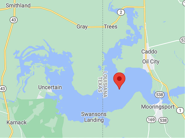 |
Caddo Lake is a 25,400 acres lake and wetland on the border between Texas and Louisiana, in northern Harrison County and southern Marion County in Texas and western Caddo Parish in Louisiana.
This lake was the only natural lake in Texas until it was artificially dammed in the early 1900s when oil was found and for flood control in 1914. A new dam replaced the old one in 1971.
Some of the cypress trees in the swamp are more than 400 years old. The average depth of the lake is 8 to 10 feet, with the deep water in the bayou averaging about 20 feet. The lake contains 71 species of fish, and it is especially good for crappie and largemouth and white bass.
The denseness of the swamp creates an inviting maze for paddlers in kayaks and canoes. On the Texas side, at Caddo Lake State Park, there are 10 kayak/canoe trails, with names like Hell's Half Acre, Cathedral Trail, Old Folks Playground and Turtle Shell Trail. The trails are marked, and maps are provided.
For more information on the park, located at 245 Park Road 2, Karnack, TX, phone 903.679.3351
Read more about Caddo Lake
#10 - Lake Conroe
|
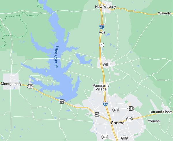 Map showing the location of Lake Conroe |
Lake Conroe is a 20,118 acre lake in Montgomery County impounded in 1973. The lake lies on the West Fork of the San Jacinto River, just west of Interstate 45 off State Highway 105. It is located about an hour north of Houston.
The lake is over 20 miles in length with an average depth of 20 feet and a maximum depth of 70 feet. It features 150 miles of shoreline, and is bordered on the north by the Sam Houston National Forest.
Lake Conroe is dominated by open water in the lower two-thirds of the reservoir, with some standing timber still present along the river channel in the upper reaches. Most of the standing timber is slightly submerged when the lake is at conservation pool, making navigation hazardous in these areas.
Lake Conroe was built as a joint project of the City of Houston, the Texas Water Development Board, and the San Jacinto River Authority in 1973 as an alternate water source for the City of Houston. The dam is 2.2 miles in length (11,280ft).
Read more about Lake Conroe
#11 - Jim Chapman Lake
|
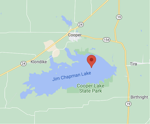 |
Jim Chapman Lake, also known as Cooper Lake, is a popular attraction for residents and tourists in the Upper East Texas area, offering boating, swimming, and fishing opportunities. The lake is located about twelve miles north of Sulphur Springs and one mile south of the City of Cooper on the border of Delta and Hopkins Counties. It has a surface area of 19,305 acres and a maximum depth of 55 feet.
Besides flood control, the lake also supplies water to the North Texas Municipal Water District, the Sulphur River Municipal Water District and City of Irving.
The lake was created by the Jim Chapman Dam which impounds the South Sulphur River, a fork of the Sulphur River. The top of the rolled earthfill dam is at the elevation of 464.5 feet above mean sea level. The lake was impounded in 1991.
The lake was formerly known as Cooper Lake, but was renamed by an act of Congress in 1998 to honor Jim Chapman, a former congressman from nearby Sulphur Springs.
Cooper Lake State Park retains the earlier name. The park contains several picnic areas, campgrounds, and a large swimming area as well as several hiking and equestrian trails.
Read more about Jim Chapman Lake
#12 - Wright Patman Lake
|
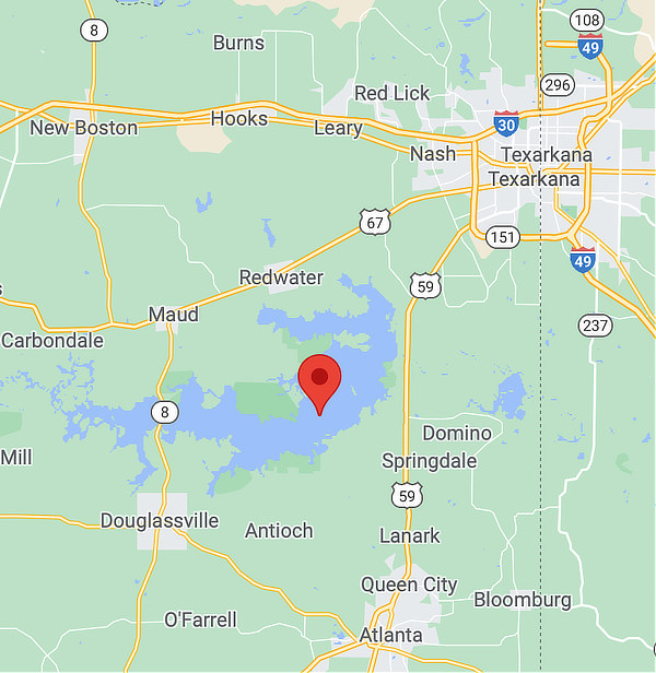 |
Wright Patman lake is on the Sulphur River in Bowie and Cass counties, 10 miles southwest of Texarkana. Its surface area covers 18,994 acres, and features a maximum depth of 40 feet. It was impounded in 1956.
The lake is formed by water impounded by Wright Patman Dam. The water is mainly from the Sulphur River, but several smaller creeks also flow into the lake.
Originally known as Texarkana Reservoir, the lake was later renamed to Lake Texarkana. Construction of the dam began in 1948, and the lake was formed when water was impounded in 1953. In 1973, the lake and dam were renamed in honor of Congressman Wright Patman of Texas. The lake features 170 miles of shoreline.
U.S. Highway 67 runs from Texarkana southwest across Wright Patman Lake's northern side, and U.S. 57 runs south on the eastern side to Queen City and Atlanta. Texas State Highway 8 traverses south from Maud to Douglassville on the lake's western side. New Boston lies to the north of the lake.
White bass are very popular at Wright Patman, with high numbers of quality-size fish available for harvest. Crappie are also popular at Wright Patman, with large numbers of legal-size fish available. The U.S. Army Corps of Engineers maintains nine parks around Wright Patman Lake.
These parks provide lake access for boating, swimming, and fishing; as well as camping, picnicking, hiking, equestrian trails, and other outdoor activities. Atlanta State Park is also located on the south shore of the lake.
Read more about Wright Patman Lake
#13 - Lake O' the Pines
|
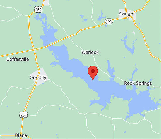 |
Lake O' the Pines is located on Big Cypress Creek in the Cypress River Basin, 25 miles northeast of Longview in Marion, Morris, Upshur, and Camp counties.
The lake(formerly known as "Ferrell's Bridge Reservoir") was created by the construction of the Ferrells Bridge Dam on the Big Cypress Bayou approximately 81 miles upstream from the bayou's confluence with the Red River. The reservoir was created as part of the overall plan for flood control in the Red River Basin below Denison Dam in Oklahoma.
The U.S. Army Corps of Engineers began construction of the dam in January 1955 and the dam was completed on December 11, 1959. It has a surface area of 16,919 acres, and a maximum depth of 49.5 feet.
In addition to a providing a variety of recreational options, the lake provides water supply storage for the Northeast Texas Municipal Water District which serves the cities of Jefferson, Ore City, Lone Star, Avinger, Hughes Springs, Daingerfield, and Longview.
Boating and fishing access is provided by the Corps of Engineers, Marion County, and private marinas. Launch fees are charged at most boat ramps; however, the Corps maintains five free ramps in addition to developed park areas.
Campsites with water and electricity are available at Brushy Creek, Buckhorn Creek, Johnson Creek, and Alley Creek. Primitive camping is available at Cedar Springs and Hurricane Creek.
The lake's diverse fish community offers many angling opportunities. White bass are native to the Cypress River Basin; the population is abundant and contains many legal-size fishes.
Nearby communities include Jefferson, Ore City and Avinger.
Read more about the Lake O' the Pines
#14 - B.A. Steinhagen Reservoir
|
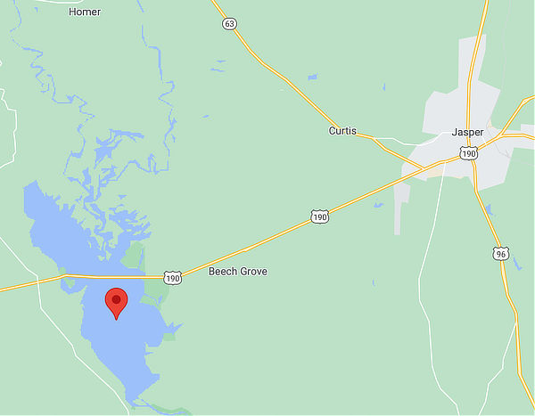 |
The B.A. Steinhagen Reservoir is located on the Neches River 14 miles west of Jasper, crossed at its midpoint by U.S. Highway 190. It has a surface area of 10,687 acres, a maximum depth of 35 feet and stretches 8 miles long and 4 miles wide.
The project is one of four reservoirs authorized in the Angelina-Neches Rivers basin. The Sam Rayburn Reservoir, formerly known as McGee Bend Reservoir, was completed in 1965. The other two projects, "Dam A" and "Rockland" are classified as deferred.
In July, 1967, "Dam B" was renamed Town Bluff Dam and B. A. Steinhagen Lake.
Martin Dies, Jr. State Park is a 705-acre recreation area nestled next to B.A. Steinhagen Reservoir. The park offers a variety of outdoor activities, including camping at over 200 campsites, paddling, fishing, swimming, hiking, biking and more.
Read more about Steinhagen Reservoir
#15 - Lake Bob Sandlin
|
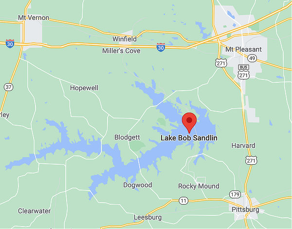 |
Lake Bob Sandlin is located on Big Cypress Creek 5 miles southwest of Mount Pleasant in Titus, Camp, and Franklin counties. The City of Pittsburg is located to the southeast of the lake.
It has a surface area of 9,004 acres, and a maximum depth of 65.6 feet. It was impounded in 1977.
The lake features 75 miles of shoreline. The lake was named in honor of its major proponent, local businessman, civic leader, and Titus County Fresh Water Supply District No. 1 president Bob Sandlin.
The Fort Sherman Dam is named after the local historic site. First construction of the dam began in 1974. The earthfilled dam was built to a maximum height of 69 feet, a top width of 25 feet, and is 10,800 feet long. A formal ceremony dedicated the lake on June 25, 1978.
Lake Bob Sandlin State Park is a 639.8-acre park located on the heavily wooded shoreline on the north side of Lake Bob Sandlin.
Read more about Lake Bob Sandlin
List of East Texas Area Lakes by Acres
Lake Name |
Size (Acres) |
| Toledo Bend Reservoir | 181,600 |
| Sam Rayburn | 114,500 |
| Livingston | 90,000 |
| Richland-Chambers | 41,356 |
| Tawakoni | 37,879 |
| Cedar Creek | 32,623 |
| Fork | 27,264 |
| Palestine | 25,560 |
| Caddo | 25,400 |
| Conroe | 20,118 |
| Jim Chapman - Cooper | 19,305 |
| Wright Patman | 18,994 |
| O' the Pines | 16,919 |
| Bois d'Arc (new) | 16,641 |
| Steinhagen | 10,687 |
| Bob Sandlin | 9,004 |
| Ralph Hall (new) | 7,600 |
| Pat Mayse | 5,940 |
| Martin Creek | 4,981 |
| Cherokee | 3,749 |
| Murvaul | 3,397 |
| East Lake Tyler | 2,276 |
| Tyler | 2,224 |
| Nacogdoches | 2,212 |
| Fairfield | 2,159 |
| Monticello | 2,001 |
| Striker | 1,863 |
| Athens | 1,799 |
| Lone Star - Ellison Creek Reservoir | 1,500 |
| Sulphur Springs | 1,340 |
| Houston County | 1,330 |
| Jacksonville | 1,320 |
| Welsh | 1,269 |
| Brandy Creek Reservoir | 1,242 |
| Bonham | 1,020 |
| Gilmer | 1,010 |
| Quitman | 814 |
| Winnsboro | 806 |
| Kurth | 726 |
| Naconiche | 692 |
| Holbrook | 653 |
| Hawkins | 633 |
| Pinkston | 523 |
| Gladewater | 481 |
| Timpson | 223 |
| Raven | 203 |
| Bellwood | 170 |
| Lomond | 92 |
| Daingerfield State Park | 80 |
| Tyler State Park | 64 |
Map of Lakes in the East Texas Area
Zoom / pan map for more detail, and click on icons for lake details. Click on this icon |
Information & Status of Lakes Across Texas
- For more information on all Texas lakes, visit Texas Freshwater Lakes supplied by Texas Parks and Wildlife. This site provides an alphabetical listing of 150 Texas lakes as well as a clickable map of lakes by region.
- Also available from Texas Parks and Wildlife is a listing of Texas Community Fishing Lakes. A Community Fishing Lake (CFL) is a public impoundment 75 acres or smaller located within an incorporated city limits or a public park, or any impoundment lying totally within the boundaries of a state park.
- A summary of Texas lake levels is available at the website of the U.S. Army Corps of Engineers - Fort Worth District
- The status of Texas water supplies is accessible at the website of the Texas Water Development Board
