Ark-La-Tex Region
The Ark-La-Tex is a region consisting of southwest Arkansas, northwest Louisiana and northeast Texas. It typically includes a total of 39 counties/parishes in these three states, although there is no official boundaries. Some definitions of the Ark-La-Tex also include McCurtain County in extreme southeast Oklahoma.
The population of the region is about 1,500,000 residents. The largest city is Shreveport, Louisiana, followed by Longview and Texarkana in Texas. The region spans about 14,000 square miles.
Although use of the term to refer to the tri-state region dates back to the early 1900s, the name "Ark-La-Tex" was regionally defined by a Shreveport Chamber of Commerce promotional campaign developed in 1932–33 to increase tourism in the area.
Counties of the Ark-La-Tex Region
There are different versions of what counties actually comprise the Ark-La-Tex. Here is the most common list of Arkansas and Texas counties and Louisiana parishes included in the region:
| Arkansas (10) | Louisiana (13) | Texas (16) |
| Columbia | Bienville | Bowie |
| Hempstead | Bossier | Camp |
| Howard | Caddo | Cass |
| Lafayette | Claiborne | Gregg |
| Little River | DeSoto | Harrison |
| Miller | Jackson | Marion |
| Nevada | Lincoln | Morris |
| Ouachita | Natchitoches | Nacogdoches |
| Sevier | Red River | Panola |
| Union | Sabine | Red River |
| Union | Rusk | |
| Webster | Sabine | |
| Winn | San Augustine | |
| Shelby | ||
| Titus | ||
| Upshur |
Map of the Counties of the Ark-La-Tex Region
Shown below is a map of the counties of Arkansas (10), parishes of Louisiana (13) and counties of Texas (16) typically considered to be part of the Ark-La-Tex. Some definitions also include McCurtain County in Oklahoma (light green on the map).
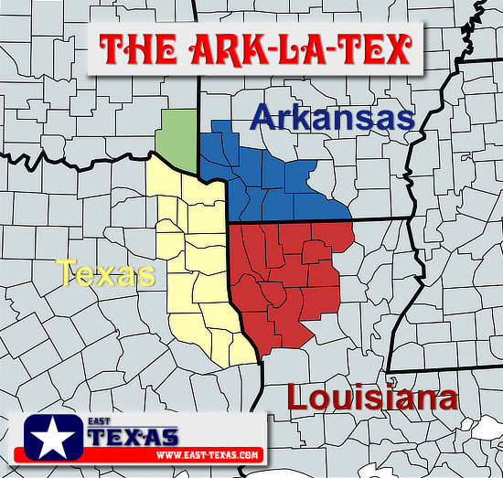 Map courtesy of www.MapChart.net |
Interactive Map of the Ark-La-Tex
The Three States USGS Monument
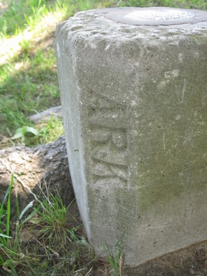
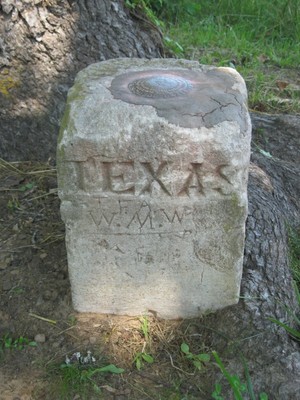
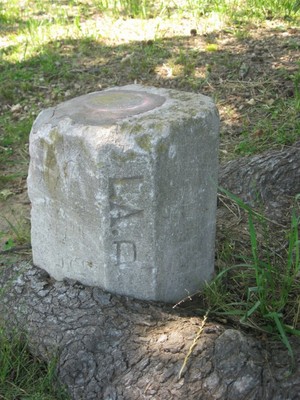
Most people in this area know about the "Ark-La-Tex", but some do not know where the states of Arkansas, Louisiana and Texas geographically meet. There is a concrete monument about 11 miles southeast of Atlanta Texas on Texas Highway 77 that marks the exact location. It is also the termination point of Louisiana Highway 1, northwest of Zylks and Rodessa, Louisiana, and about 43 miles from Shreveport. The community of Ravanna, Arkansas lies directly to the north.
This U.S. Coast & Geodetic Survery Triangulation Station identifies the meeting of the states of Arkansas, Louisiana and Texas. The station also marks the location where Lafayette County Arkansas, Cass County Texas and Caddo Parish Louisiana meet. Most survey marks across the country were set by the U.S. Coast & Geodetic Survey, now called the National Geodetic Survey (NGS).
This marker is at Latitude 33 01 09.19955(N) Longitude 094 02 35.21446(W), and labeled as NGS DM1223. The monument was placed by the Coast & Geodetic Survey in 1930. The site is located in USGS Ravanna Quad. View the NGS Data Set for DM1223
The concrete monument resides at the base of an ever-encroaching tree. A colorful sign marking the site was erected in 2023 by local residents and sponsored by the nearby Magnolia Club House in Louisiana. See photos below.
Photos of the Ark-La-Tex Three State Marker
Welcome to the Three States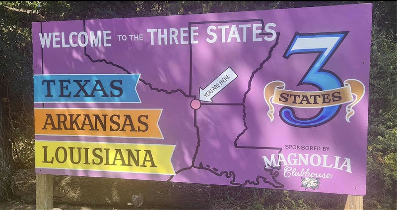 |
||||
The Three States marker and sign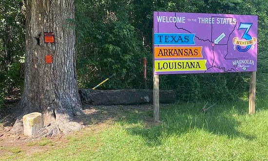 |
The Three States Marker at the base of the encroaching tree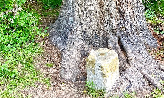 |
|||
| The U.S. Coast & Geodetic Survery Triangulation Station DM1223 marking the meeting of Arkansas, Louisiana and Texas $250 fine or imprisonment for disturbing this mark For information, write to the Director, Washington, D.C. 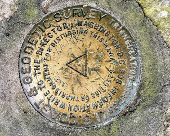 |
||||
|
||||
Entering Cass County at the Texas State Line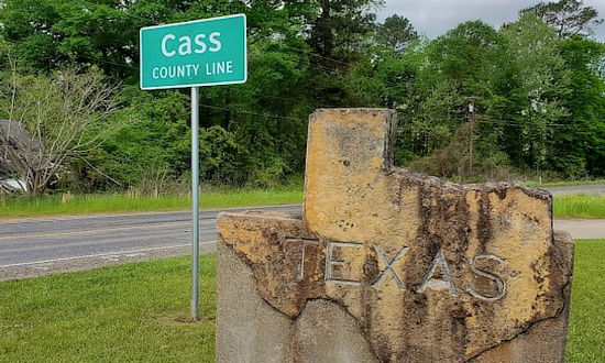 |
Entering Caddo Parish at the Louisiana State Line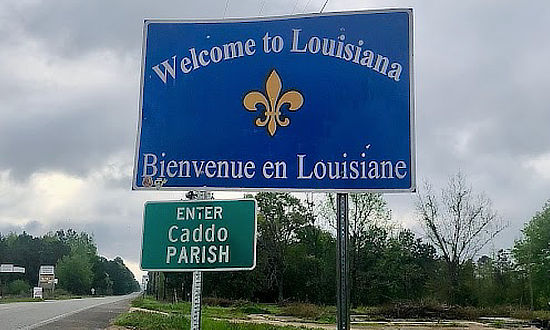 |
|||
 |
