Cooper Texas
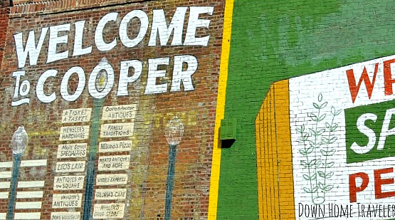
 "Welcome to Cooper" mural |
The City of Cooper is the county seat of Delta County, in Upper East Texas. It is located between the north and south forks of the Sulphur River.
The city lies south of Paris, Texas, and north of Sulphur Springs, on Texas State Highway 154 and FM 64.
Delta County is named for its triangular shape, like the Greek letter "delta". Two forks of the Sulphur River form its northern and southern boundaries, and meet at its easternmost point. It was founded in 1870.
Cooper Lake State Park
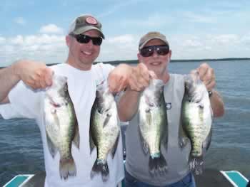
Jim Chapman Lake, also known as Cooper Lake, is the most popular tourist attraction in the area, offering visitors boating, swimming, and fishing. Along the north shore of the lake is the Doctor's Creek Unit of Cooper Lake State Park.
The park contains several picnic areas, campgrounds, and a large swimming area. The park also contains several hiking and equestrian trails.
Jim Chapman Lake
Jim Chapman Lake, also known as Cooper Lake, is the most popular tourist attraction in the area, offering visitors boating, swimming, and fishing. Along the north shore of the lake is the Doctor's Creek Unit of Cooper Lake State Park. The park contains several picnic areas, campgrounds, and a large swimming area. The park also contains several hiking and equestrian trails. Read more about Jim Chapman Lake |
Cooper Website Resources |
|
Population |
In 2020, Cooper had a population of 1,911. |
Area Code |
903 and 430 |
Zip Code |
75432 |
Interactive Map of Cooper Texas (courtesy of Google)
Map Showing Location of Cooper in Upper East Texas

Lake Tawakoni
Lake Tawakoni, also known as the Iron Bridge Dam and Reservoir Project, was the first major project built by the Sabine River Authority of Texas. Lake Tawakoni has a surface area of about 36,700 acres. The dam is located about 10 miles northeast of Wills Point, and the reservoir lies within parts of Hunt, Rains, and Van Zandt Counties. The project's primary purpose is one of water conservation and supply. The reservoir as-built storage capacity at conservation pool elevation of 437.5 mean sea level . The South Fork, Cowleech Fork, and Caddo Forks that all formed the Sabine River headwaters are now submerged under the lake and the lake now serves as the headwaters of the Sabine River. Nearby is the Lake Tawakoni State Park which offers fishing, boating, camping, hiking, birding and other outdoor activities.
|
Lake Fork
At 27,264 acres and 315 miles of shoreline, Lake Fork was designed to be a premier bass fishing lake and currently holds records for 34 out of the Top 50 largemouth bass caught in Texas. This popular lake located on the Sabine River in Hopkins, Rains and Wood Counties, 5 miles northwest of Quitman, and north of Mineola. It was impounded in 1980, and today reaches a depth of 70 feet. Largemouth bass is the most popular sportfish in this reservoir. A combination of restrictive harvest regulations, stocking of Florida strain largemouth, and abundant habitat has contributed to Lake Fork's development as one of the country's premier trophy bass lakes.
|
Other East Texas Attractions
While visiting Cooper and Delta County area, you may want to take other interesting day trips in several directions:
- Jefferson - antiques, Jay Gould's railroad car, Jefferson Carnegie Library, steam train rides, steamboats on Caddo Lake, B&Bs
- Gladewater - antique capitol of East Texas, Gusher Days, Roundup Rodeo, Helen Lee Daffodil Gardens
- Gilmer - East Texas Yamboree, Historic Upshur Museum, Lake Gilmer
- Kilgore - home of the East Texas Oil Museum and Kilgore College
- Joinerville Texas - Daisy Bradford oil discovery monuments and Great East Texas Oilfield markers, Gaston Museum
- Longview - Gregg County Fair & Exposition, Longview Museum of Fine Arts, R.G. LeTourneau Museum, Great Texas Balloon Race, historic buildings, shopping, restaurants
- Marshall - Michelson Museum of Art, Starr Family home State Historic Park, Harrison County Historical Museum, Ginocchio Hotel, T&P Railroad Museum, Christmas Wonderland of Lights
- Carthage - Texas Country Music Hall of Fame, East Texas Oil & Gas Blast, Piney Woods Quilt Festival Rode Jamboree
- Tyler - Municipal Rose Garden, TJC Planetarium, Caldwell Zoo, Tyler Museum of Art, Brookshire's Museum & Country Store, Lake Tyler, Rose Rudman Recreational Trail, Cotton Belt Depot, Goodman-LeGrand House
- Lake Tyler - swimming, boating, fishing, skiing close-in to Tyler
- Lake Palestine - Boating, fishing, skiing and camping, just south of Tyler
- Lindale - Old Mill Pond Museum, Hideaway Lake, Miranda Lambert Store & Red 55 Winery
- Mineola - Mineola Nature Preserve
Travel Information for the Cooper Area


