Richland-Chambers Reservoir
Lakes in the East Texas Area
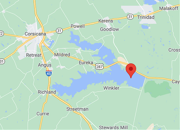
 Map showing the location of the Richland-Chambers Reservoir |
In East Texas, there are over 50 lakes offering a variety of outdoor sports for vacations or weekends. These lakes provide fishing, swimming, water skiing, houseboats, jet skis, sailing and other outdoor and hiking activities.
Within easy driving distance are lakes such as Toledo Bend Reservoir, Caddo Lake, Lake Fork, Sam Rayburn, Lake Tawakoni, and many others.
Richland-Chambers Reservoir
The Richland-Chambers Reservoir is the third largest inland reservoir by surface area (behind the Sam Rayburn Reservoir and Lake Livingston) and the 8th largest reservoir by water volume in Texas. It covers an area of 41,356 acres.
It was formed by the impoundment of Richland Creek and Chambers Creek east-southeast of the town of Corsicana and south of Kerens, in Navarro County and Freestone County, Texas, USA. It has 330 miles of shoreline and is "Y" shaped with the dam located on the eastern end of the lake. It was formerly known as the Richland Reservoir.
Due to a drought in 1956-1957 plans were made by the Tarrant Regional Water District to build the Richland-Chambers Reservoir with the purpose of being a public water source for Tarrant County.
The reservoir was built by the Tarrant Regional Water District (TRWD) who retains most of the water rights. TRWD is a water wholesaler to 11 counties in Texas. This water is pumped from Richland-Chambers via a 90-inch (2,300 mm) pipeline to balancing reservoirs and on to Lake Benbrook for storage before moving to the water treatment plants or Eagle Mountain Lake.
Richland-Chambers Dam is an earthen embankment with a soil cement upstream face and six and half miles long with a maximum height 120 feet. The top of dam is at the elevation of 330 feet above mean sea level.
The reservoir is 60 miles southeast of downtown Dallas, with Interstate 45 running north-south just west of the reservoir.
Outdoor Recreation at the Reservoir
Although its primary purpose is as a water supply reservoir, the Richland-Chambers Reservoir is a popular destination for outdoor recreation, including fishing, boating, and swimming.
The Harbor Inn Restaurant & Club, sitting on the banks of the lake adjacent to Northshore Harbor Condominiums, provides a restaurant and bar for visitors of the lake. There are a number of sites to launch boats.
Read more about public access to the Richland-Chambers Reservoir at the website of Texas Parks & Wildlife
Fishing at Richland-Chambers Reservoir
Richland Chambers is an excellent choice for anglers seeking catfishes, crappie, white bass or hybrid stripers.
Angling for largemouth bass can be very good where anglers can find vegetation and clear water; however, these areas are somewhat limited in size compared to the lake surface.
Many anglers set jug lines for catfishes and go after schooling white bass and hybrids while waiting for jug line action. Richland Chambers produces abundant crappie (both black and white) and may be area's the most consistent fishery for these fishes.
Read more about fishing the Richland-Chambers Reservoir at Texas Parks & Wildlife
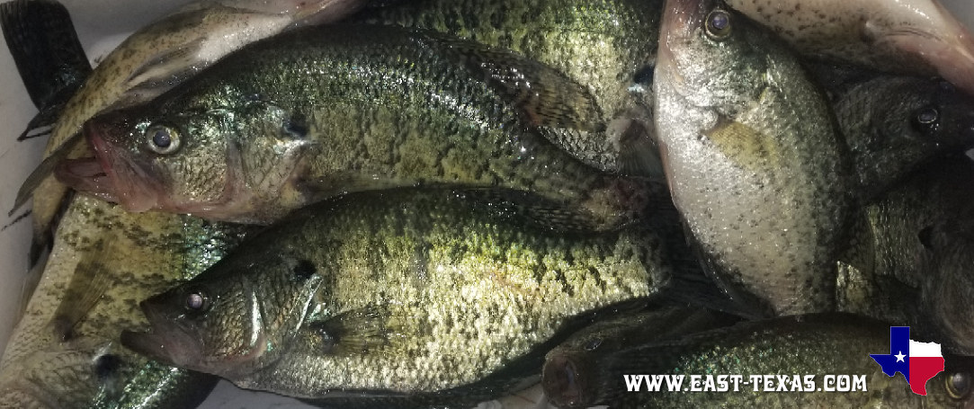
Another great day of Crappie fishing on the Richland-Chambers Reservoir! |
|
Map of the Richland-Chambers Reservoir Area


