South East Texas
The East Texas Region
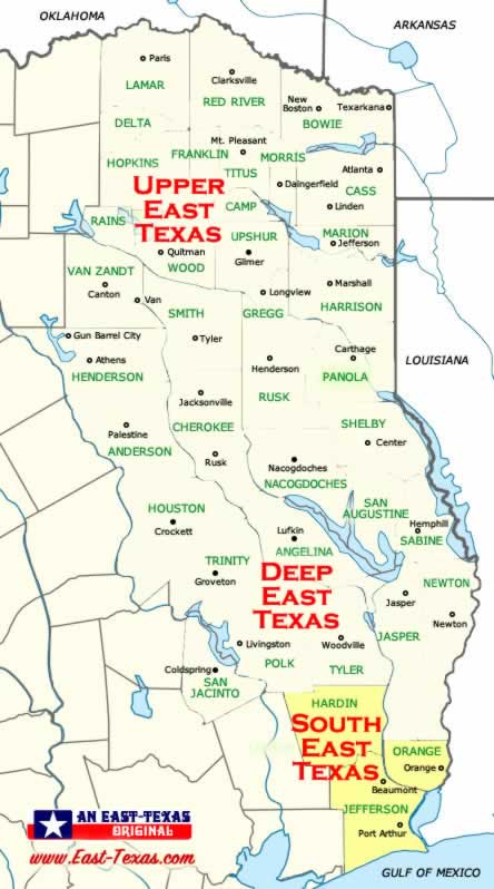
East Texas is generally considered to be the region east of Interstate 45, and west of the Louisiana border.
The northern border is Oklahoma, and the southern edge is the Gulf.
East Texas is frequently sub-divided into three areas: Upper East Texas, Deep East Texas, and South East Texas.
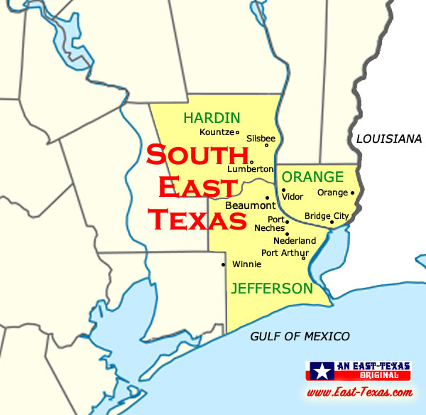
The 3-county South East Texas area includes Hardin, Orange and Jefferson Counties, and cities such as Beaumont, Orange and Port Arthur.
It borders the Sabine River to the east, and the Gulf of Mexico to the south. Deep East Texas lies to the north, and Upper East Texas borders Oklahoma and Arkansas.
Interstate Highway 10 runs through the area in an east-west alignment. Other important highways running generally in a north-south direction include U.S. 69, U.S. 96 and U.S. 287.
The population of the 3-county area is about 397,000 residents.
Map Showing Location of South East Texas

Map of South East Texas Counties and Major Cities

List of South East Texas Counties and County Seats
The following is a list of the 3 counties and county seats in South East Texas, with links to the official website of each county and the Federal Census Bureau 2020 population counts:
County Name |
County Seat |
Population |
| Hardin County | Kountze | 56,231 |
| Jefferson County | Beaumont | 256,526 |
| Orange County | Orange | 84,808 |
| Total - 3 Counties | 397,565 |
List of South East Texas Cities and Towns
Among the cities and towns in the South East Texas area are the following:
|
Little Cypress Mauriceville |
Sabine Pass Saratoga Sour Lake |
South East Texas City Governments and City Websites
 |
Important Area Weather Resources |
|
Area Media OutletsKFDM-TV - Beaumont Weather Other Texas Weather Sources |
|
