East Texas Mountains ... and Mounts
Random Thoughts as We Explore East Texas Geography
We love driving around East Texas, visiting the larger cities, and the smaller communities as well. From the Gulf Coast at Port Arthur to Texarkana in the north, the geography and geology are varied. From sea level to its high points, East Texas is a pleasure to explore!
The Mountains of Texas
The State of Texas is home to 2,164 named mountains, peaks, and hills. Guadalupe Peak (8,757ft / 2,669m) is the highest point, and Emory Peak (7,785ft / 2,373m) is considered the most prominent point.
Texas has more than forty mountain ranges, all of them located in its eight westernmost counties; three are considered major mountain ranges: the Franklin, Guadalupe, and Davis.
The Guadalupe Mountains are situated in Northwestern Culberson County, 110 miles east of El Paso on U.S. 62/180. The Franklin Mountains are near El Paso, while the Davis Mountains are near Fort Davis in Jeff Davis County.
Texas has 91 mountains a mile or more high, with the highest being Guadalupe Peak at 8,749 feet. Those are concentrated in southwest Texas, around Big Bend National Park and Guadalupe Mountains National Park.
 |
Big Bend National Park is located in extreme southern Texas, along the Rio Grande River. The closest towns include Terlingua, Marathon, Marfa, Alpine, Sanderson, Fort Davis and Valentine.
Big Bend is one of the largest, most remote, and one of the least-visited national parks in the contiguous United States. The Park encompasses an area of 801,163 acres, and shares the border with Mexico for 118 miles. It is the largest protected area of Chihuahuan Desert topography and ecology in the United States.
From an elevation of 1,800 feet along the banks of the Rio Grande to almost 8,000 feet at the top of the park's Emory Peak, the trails of Big Bend offer experiences, variety, and vistas that visitors love.
| Mountain Trail Region of Texas |
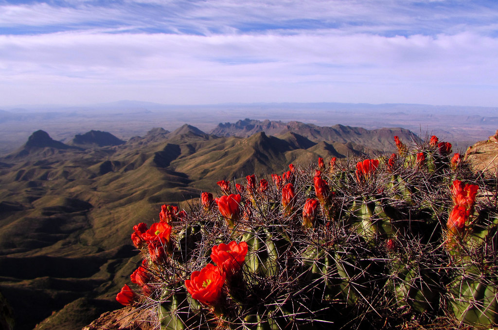
| South Rim vista at Big Bend National Park in southern Texas (Photo courtesy of NPS) |
 |
The Mountains and "Mounts" of East Texas
South East Texas straddles the Gulf of Mexico, at an elevation, of, well, sea level. Further north, the geology expands to higher elevations. In East Texas, there ARE "mountains", but on a much smaller scale than those out west, and more appropriately called "high hills" or "peaks".
For example, Rocky Mountain, also known as Rocky Mount, was on State Highway 103, 22 miles southeast of Nacogdoches in southeastern Nacogdoches County. Snow Mountain is located southeast of Bullard!
Here are some other mountain-related place names in East Texas ...
Mount Pleasant Texas
Located about 80 miles northeast of Tyler on U.S. Highway 271 at its intersection with U.S. Highway 67 and Interstate I-30 is the City of Mt. Pleasant, the county seat of Titus County.
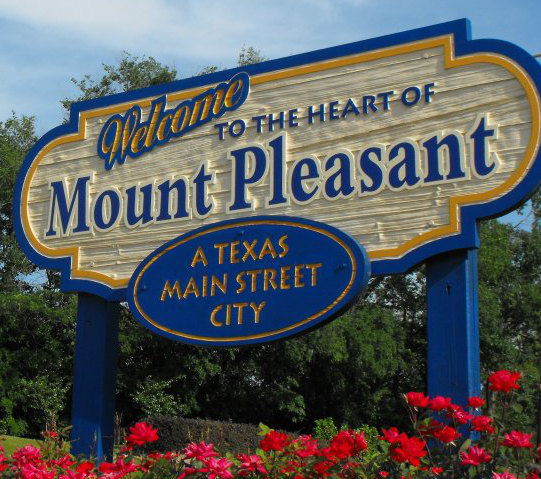 Welcome to Mount Pleasant ... A Texas Main Street City |
The population of Mt. Pleasant is about 16,000 residents as of the 2020 Federal Census. Elevation is 404 feet above sea level.
The City of Mount Pleasant was selected by the Texas Historical Commission to become an official Texas Main Street City in 1993 and has been a Nationally Recognized program since 2010.
Mount Pleasant has grown and prospered over the past 100 years. Its location along primary transportation routes such as I-30 and the new State Highway 271 Loop, as well as a strong independent attitude of the population has furthered that growth. Today, 32,000 people call Mount Pleasant & Titus County home. They work in what is the hub of a five county region. In addition to being a regional employment center, Mount Pleasant also offers quality retail shopping with a 2018 retail trade area of 106,000 persons.
Whatley Center for the Performing Arts is located at Northeast Texas Community College and includes both a beautiful theatre and an art gallery. The Whatley Center presents a professional performing arts series, college theatre productions and changing art shows during the season September through May.
The Mount Pleasant Main Street District is a 42- block area located in the central business district of downtown Mount Pleasant.
The city is located at 404 feet above sea level.
| about Mount Pleasant on this website |
Mount Vernon, Texas
 |
The City of Mount Vernon is located in Franklin County Texas on Interstate Highway I-30. State Highway 37 traverses the city north to south, and U.S. Highway 67 passes through the city east to west.
The city is situated 80 miles west of Texarkana, and 104 miles east of Dallas. Its population is about 2,500 residents as of the 2020 Federal Census.
Mount Vernon is a National Main Street City, a Certified Retirement Community and a Keep Texas Beautiful City.
The Mount Vernon Zip Code is 75457, and its Area Code is 903. For more information, visit the official website of the City of Mount Vernon.
The city is located at 492 feet above sea level.
| about Mount Vernon on this website |
The City of East Mountain
The City of East Mountain is located primarily in Upshur County, with a small area residing in Gregg County. It is situated 10 miles northwest of Longview and 7 miles northeast of Gladewater in Upper East Texas. Despite its name, the city's elevation is officially listed as only 430-feet above sea level!
The city is named for East Mountain, a nearby 660-foot wooded summit overlooking the community. The area was originally settled in the 1870s.
| about East Mountain on this website |
Mount Selman
There's also Mount Selman, south of Tyler and north of Jacksonville on U.S. Highway 69. It was established in 1884 along the Kansas and Gulf Short Line Railroad.
It has an impressive elevation (by East Texas standards) of 696 feet above sea level.
Barnwell Mountains
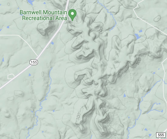 |
Located high atop the Barnwell Mountains of East Texas is one of the state's most exciting motorized off-road parks - The Barnwell Mountain Recreational Area! It is located on State Highway 155 between Gilmer and Coffeeville. Elevation is about 630 feet.
The property offers dirt bikes, UTVs and OHVs 1,850 acres of pure delight. There are 27+ miles of single track trails for dirt bikes and many more miles of challenging trails for UTVs and OHVs. There is a 16 mile Adventure Trail for the dirt biker or ATV rider looking for a less demanding ride and there are trails that even the novice UTV and OHV riders will enjoy!
The Barnwell Mountain Cabins are located across from the recreational area.
| about the Barnwell Mountain Recreational Area and Barnwell Mountain Cabins |
Lookout Mountain
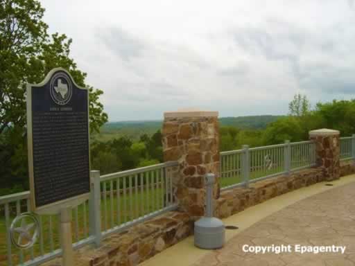 |
A short trip south of Tyler on U.S. Highway 69 is Love's Lookout, located in Cherokee County just north of the City of Jacksonville, Texas.
At an elevation of 713 feet, it has long been known for its spectacular views to the east, on clear days as far as 30-35 miles. It is often referred to by locals as "Lookout Mountain".
Love's Lookout Scenic Park is a great place for walking or for family picnics, and includes a 5,500 square foot facility with restrooms, vending machines, an information center and a sheriff's sub-station.
Love's Lookout is about 29 miles from downtown Tyler via U.S. 69, and the drive time is about 40 minutes.
| about Love's Lookout on this website |
Cusseta Mountain
Cusseta Mountain is located about 6 miles west of Douglassville, and is the highest point in Cass County with an elevation of 632 feet above sea level.
And a Few Other Mounts
Let's not forget Mount Enterprise in Rusk County, Mount Mitchell in Morris County and Mount Sterling in Nacogdoches County.
Mean Elevation of East Texas Counties
Shown in the table below is the mean elevation of counties in East Texas. The mean elevation is the sum of (county seat elevation * county land area) divided by total land area.
| County | Mean Elevation (feet) |
| Lamar | 600 |
| Smith | 544 |
| Cherokee | 518 |
| Rusk | 512 |
| Van Zandt | 505 |
| Hopkins | 502 |
| Franklin | 492 |
| Henderson | 489 |
| Anderson | 482 |
| Delta | 482 |
| Rains | 479 |
| Wood | 413 |
| Harrison | 413 |
| Red River | 410 |
| Titus | 404 |
| Morris | 397 |
| Camp | 394 |
| Cass | 381 |
| San Augustine | 371 |
| Gregg | 371 |
| Shelby | 371 |
| Upshur | 367 |
| Houston | 364 |
| San Jacinto | 361 |
| Bowie | 358 |
| Trinity | 328 |
| Angelina | 312 |
| Panola | 312 |
| Nacogdoches | 302 |
| Sabine | 279 |
| Tyler | 269 |
| Jasper | 203 |
| Marion | 194 |
| Newton | 194 |
| Polk | 167 |
| Hardin | 85 |
| Jefferson | 16 |
| Orange | 7 |
Texas Elevation Resources
Carl Monk Overlook
